In February 2019, Dr Ian Davenport and Dr Iain McNicol, postdoctoral researchers at the University of Edinburgh, travelled to the Republic of Congo as part of the first CongoPeat field campaign. The aim was to fly a large unmanned aerial vehicle (UAV) over the Congo Basin to help determine how much carbon-rich peat exists below the forest canopy. Dr Ian Davenport reports on initial findings.
Our earlier work has shown that there could be about 30 billion tonnes of carbon stored in the peat under these peat forests, about three times the annual global fossil fuel output. The second field campaign (June – Aug 2019) will seek to improve the confidence of this estimate (the current 95% confidence limit is 6.3-46.8 billion tonnes – a very wide range!). We believe this carbon could be rapidly released to the atmosphere if the peat is drained for agriculture (e.g. palm oil, as has happened to similar peat forests in much of Indonesia and Malaysia), or under the increased temperatures and changed rainfall patterns of climate change. The CongoPeat project aims to reduce this uncertainty in both current carbon stocks, and what will happen in the future, in order that we can hopefully prevent the carbon being released.
Part of this effort is determining whether the peat is formed into domes, as typical with rain-fed peatlands. Initial studies suggest not, counter to our current understanding, but the satellite-based altimetry tested by Dr Greta Dargie (University of Leeds) and Dr Edward Mitchard (University of Edinburgh) in the past was not definitive – the domes could be very subtle, with the ground rising 2-3 metres over 10-15 km, and the methods they had available were not sensitive enough to detect this. Therefore we are using a drone-based system capable of measuring the land surface elevation with an accuracy of a few centimetres to give an accurate answer.
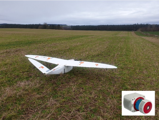
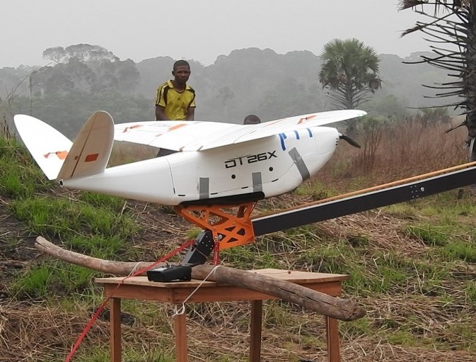
The drone (more technically known as an Unmanned Aerial Vehicle, or UAV), here set up just outside Edinburgh, is a Delair DT-26x, which has a 3 m wingspan, and is equipped with a Riegl VUX-1UAV LiDAR system (inset). This is a lightweight system capable of 500 000 measurements per second, recording multiple returns from each outgoing laser pulse.
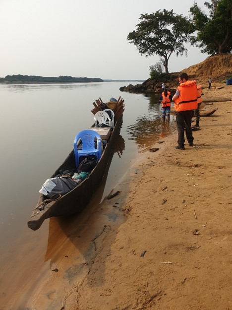
The drone was transported in parts to the field site, a 7000 km trip, along with about 200 kg of kit. Plane trips got the drone from Edinburgh to Brazzaville, capital of the Republic of Congo, then to Impfondo, Likouala Department.
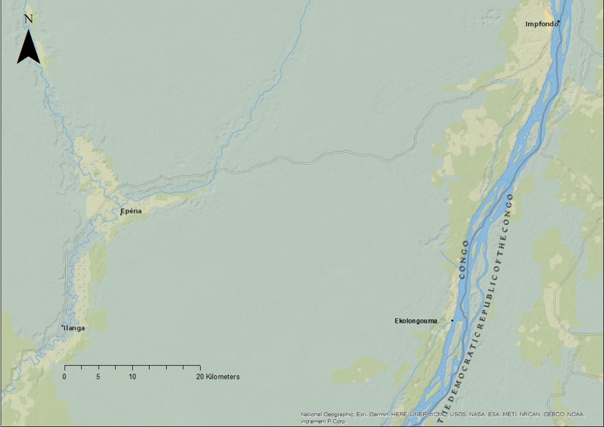
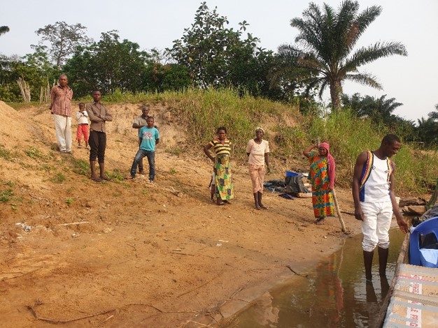
Finally, a three hour boat trip down the Ubangui, a tributary of the Congo, took us to Ekolongouma, a remote village on the eastern border of the Republic.
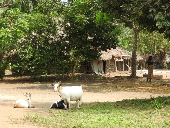
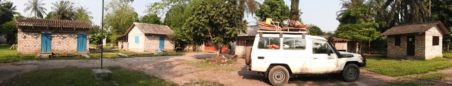
Locals, goats and chickens welcomed us into Ekolongouma village…
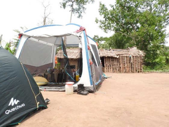
…and allowed us to set up our tents among the huts.
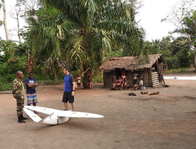
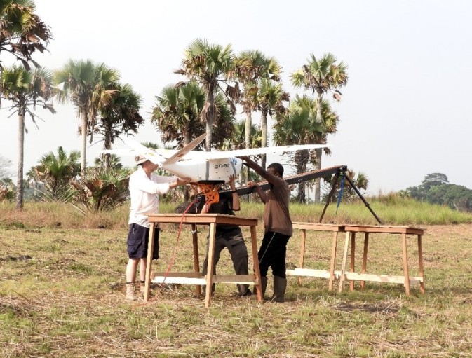
To ensure it had survived the trip, we assembled and tested the drone in Ekolongouma. The white area on the right is cassava root, which was soaked, chopped then laid out to dry. Insects loved it, and there was a perpetual buzzing cloud over it.
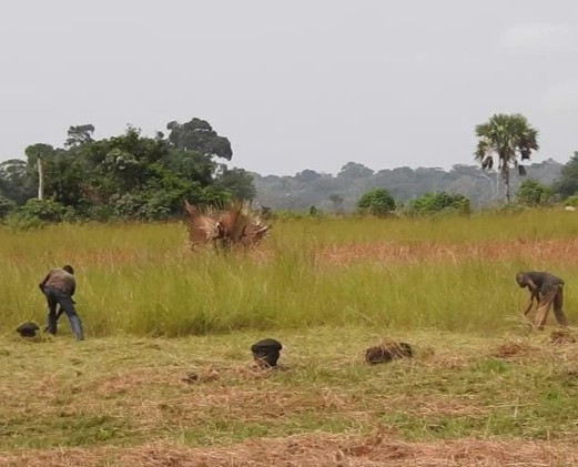
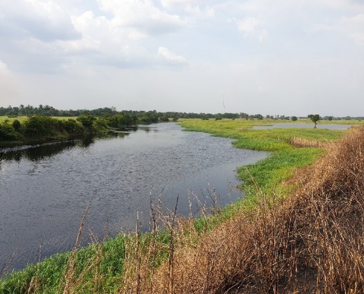
A ten minute walk got us into the savanna, where the grass is a little too high for the drone to take off and land safely. A relatively open area was found that kept trees out of the likely ascent and descent paths, and allowed take-off and landing into the prevailing wind.
Helpful locals trimmed the long grass and levelled the extinct termite mounds to create a landing strip for the drone.
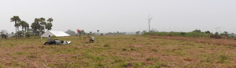
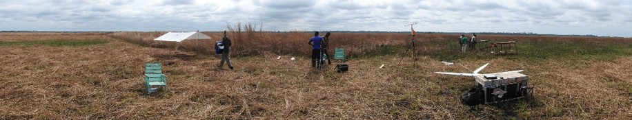
An operations canopy was set up to protect the drone and support equipment from the heat, which was around 35 Celsius most of the day, with humidity making it feel about 10 Celsius warmer. Once everything was set up, all we needed was the right wind conditions to get the drone into the air and back down safely. The low wind and frequent storms made these conditions rare.
After a few days, the wind rose, and the drone was set up on the launcher, which uses a bungee cord to catapult the drone upwards until the motor can keep it aloft. A strong head wind usually helps with lift during take-off, but the low wind in the savanna meant the drone needed some help. Here, the launcher is mounted atop a trio of tables, which gave the drone another metre of height in case there was a drop in altitude as the motor took over from the launcher as the source of lift during take-off. As a final modification, a highly-sophisticated buttress was used to keep the launcher in place as the drone is catapulted forwards.
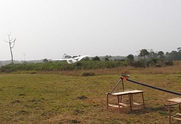
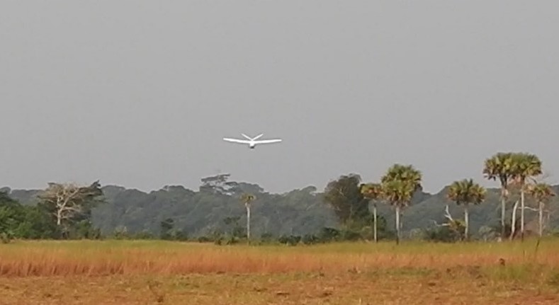
The launch went off perfectly and the drone was sent on a half-hour mission, travelling 2.2 km over the peat area of the forest at 240 m altitude, where it measured 121 million laser returns from the LiDAR instrument, mostly from the forest canopy, but about a quarter of which went through gaps in the trees to measure the ground elevation.
These ground measurements will yield important information on the surface topography, answering the ‘domed or not domed’ question, while the canopy returns will provide information on vegetation coverage, density and structure.
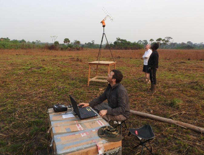
For most of the mission, while the drone flew over the forest, it was out of sight, controlled by the laptop via an antenna, which was lifted up onto a table to extend operational range.
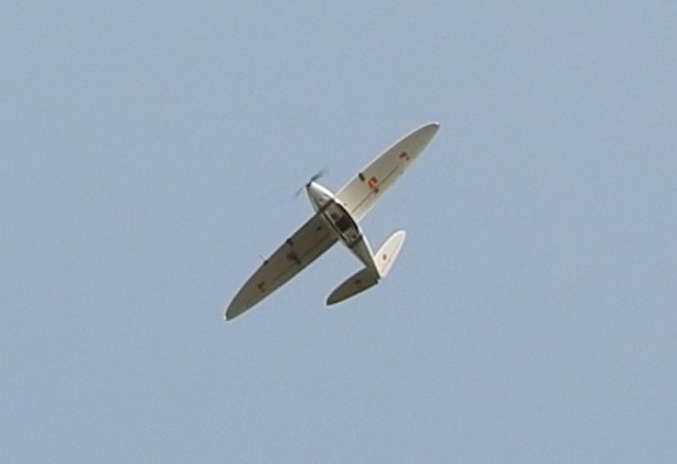
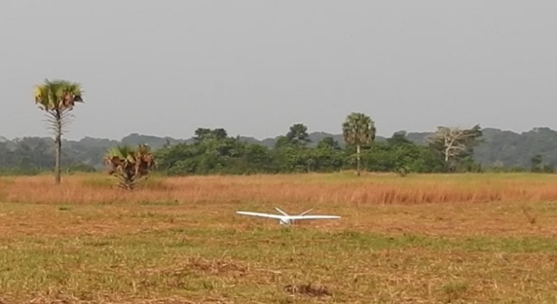
The drone came in to land safely…
…allowing the data to be downloaded.
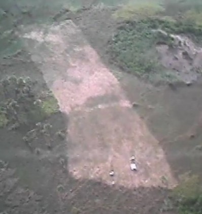
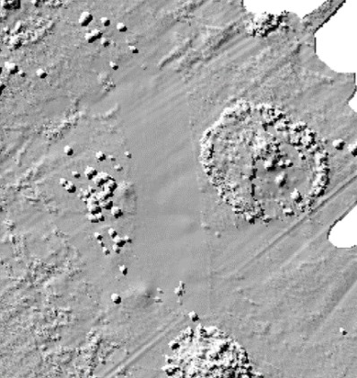
The drone’s onboard camera shows the cleared landing area, with the operations canopy and the tables used to raise the launcher at the lower edge.
Rendering the LiDAR data looking from above, the shape of the landing area, the operations canopy and tables can be seen.
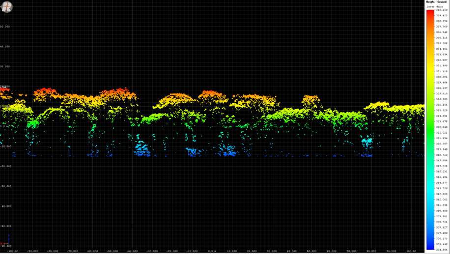
A profile through the forest shows that the LiDAR is getting a number of returns from the ground, which will enable us to determine the shape of the peatland. After a successful mission, villagers from Ekolongouma gather to wave us off, as we return everything to the boat, and head back to Impfondo. To investigate the far side of the peatland, we travelled to its western edge where we were hosted by the Wildlife Conservation Society.
54km away from the previous site…
…we crossed the river by boat…
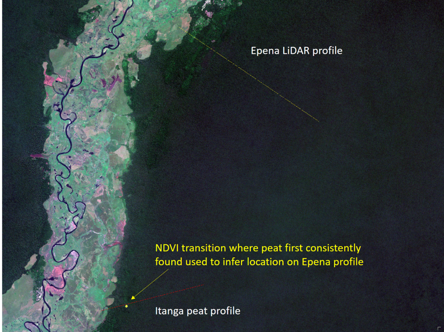
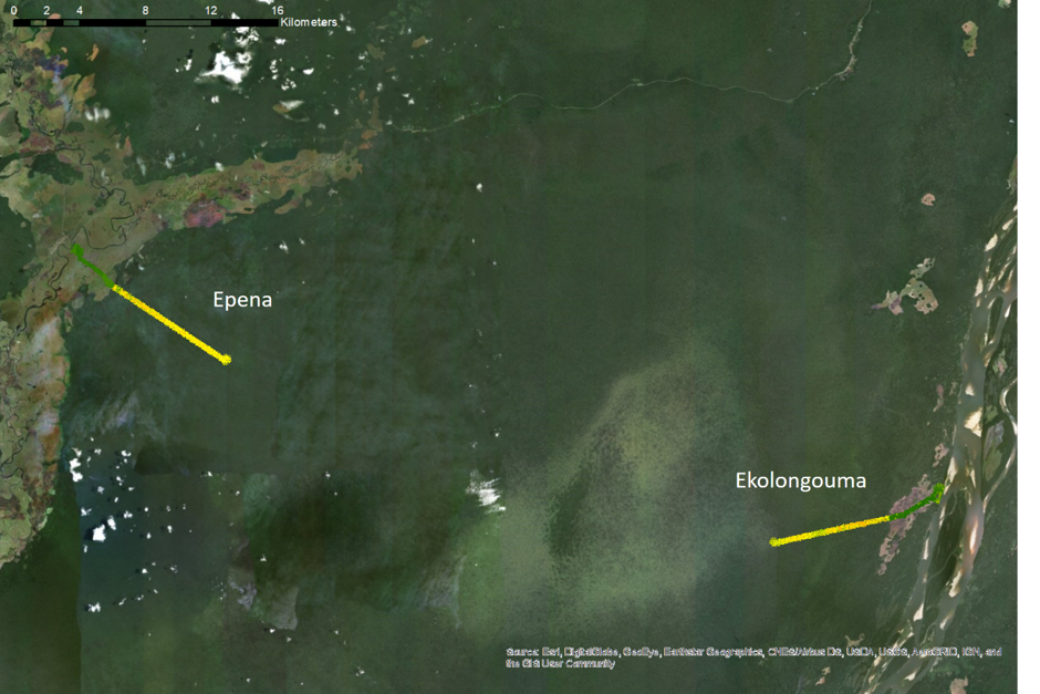
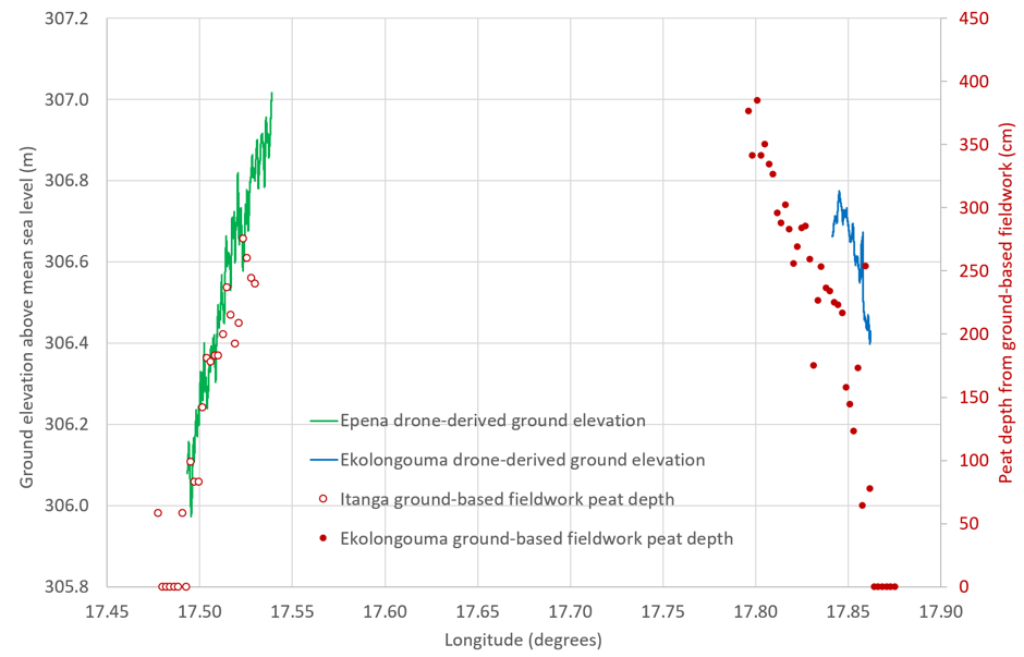
…had another landing site cleared, and carried out a second flight over the peatlands. Fieldwork was carried out in 2017 to establish the peat depth at the east and west edges of the forest, but in the west we couldn’t launch the drone from the Itanga site used by the fieldworkers, so we had to launch from Epena, 12 km north. So here we had to assume that the peat depth was related to the distance into the forest. This transect got 5.8 km into the peat. The swathes reach in from the west and east edges of the peatlands, Epena in the west and Ekolongouma in the east. The darker green is the hardwood forest, the lighter region in the east is palm-dominated. Back at Edinburgh, the two transects are being studied to determine the topography of the peatlands, and help us better understand how much carbon they store, how they function, and will respond to future change. Fieldwork carried out in 2017 established the presence and depth of peat at the edges of the forest, and the LiDAR data shows that where the peat increases in depth deeper into the forest, the top of the peat increases in elevation. A further increase in elevation towards the centre of the field that we could not reach with the LiDAR is indicated by other remotely-sensed data, suggesting a maximum height around 3-4 m above the edges.