We will also deploy new technology, led by Dr Ed Mitchard and Dr Ian Davenport at the University of Edinburgh, flying an Unmanned Aerial Vehicle over the peatlands to obtain detailed topographic maps.
Then, by combining this information with data from satellites, we can produce new accurate maps for the peatlands.
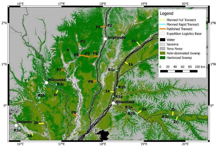
Critically, our initial discovery of the peatland included no data from the DRC, which we believe houses two-thirds of the peatland area and its associated carbon stocks. Working with Dr Corneille Ewango at the University of Kisangani, our new work will test this hypothesis and provide the first data-driven maps of the peatlands in the DRC.
Peatlands are important not just in terms of removing carbon from the atmosphere: the waterlogged conditions means these wetlands also release large quantities of the greenhouse gas methane.
Led by Dr Sofie Sjögersten and Dr Jonay Jovani Sancho at the University of Nottingham, we will use the expeditions to sample sources and sinks of methane across the region to assess the scale of on-the-ground emissions for the first time.
These measurements will be supplemented by intensive sampling at a well-studied site. Led by Professor Simon Lewis of University of Leeds and Dr Ifo Suspense Averti of Marien Ngouabi University, PhD students under their supervision, Emmanuel Mampouya and Mackline Mbemba, will track the flow of carbon between atmosphere, vegetation and peat over the course of two years. The researchers will take monthly measurements of several ecosystem processes, including leaf and woody material inputs into the peat, and their decomposition rates.
Finally, to obtain estimates of carbon stocks and greenhouse gas emissions across the region, all of our ground measurements must be scaled up using satellites.
Led by Dr Ed Mitchard, from the University of Edinburgh, this aspect of the project will establish the importance and role of the peatland in the global carbon cycle.